
What is documented
Scientific literature and SGB mapping place Pindorama within the Natividade–Pindorama regional geological context and provide the basis for a conceptual model.

Tocantins State, Brazil
Project overview
Pindorama is an early-stage mineral exploration project in the municipality of Pindorama do Tocantins. Its investment thesis begins with a documented regional geological setting—not with a declared discovery.
The current work is focused on consolidating the geological model, reducing uncertainty and defining technically defensible field checks. At this stage, VLGOLD does not declare mineral resources, mineral reserves, grades or economic viability for the project.
Location
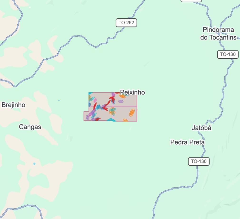
The project lies in the Natividade–Pindorama region, an area covered by scientific lithostratigraphic studies and by the Geological Survey of Brazil's statewide geological and mineral-resources mapping.
Regional geology
The Natividade Group is a predominantly metasedimentary sequence in the northern segment of the Brasília Belt. In the Natividade–Pindorama region, the sequence unconformably overlies an older basement composed of tonalitic gneisses and Paleoproterozoic granites related to the Transamazonian Cycle.
Regional lithostratigraphic work recognizes eight units in this succession. This geological diversity, combined with tectonic deformation, provides a relevant framework for investigation, but it does not by itself demonstrate mineralization within the project.
Rock types described in the regional succession
Regional information. Its occurrence, distribution and relevance within the mineral right require project-scale verification.
Natividade–Pindorama relationship
Pindorama should not be interpreted in isolation from Natividade. Scientific work treats the two localities as one study region and correlates the Natividade Group with the Araí Group, relating its evolution to a Paleo–Mesoproterozoic rifting event.
Prospecting criteria for gold
Faults, shear zones, fractures, contacts between units and deformed zones may act as pathways for hydrothermal fluids. The working rationale is therefore to test the relationship between regional structures, hydrothermal alteration, vein quartz, sulfides or iron oxides and geochemical gold responses.
Quartzite or quartz alone does not indicate gold. The exploration hypothesis only gains substance when geological, structural, mineralogical and geochemical evidence converges.
Current project status
VLGOLD's priority is to transform a relevant regional setting into a traceable technical process, communicating each conclusion according to the maturity of the available evidence.
Scientific literature and SGB mapping place Pindorama within the Natividade–Pindorama regional geological context and provide the basis for a conceptual model.
Contacts between geological units, faults, shear zones, fractures and signs of hydrothermal alteration are prospecting criteria—not evidence of an economic deposit.
The presence, continuity, geometry and grade of any mineralization can only be established through fieldwork, sampling, analysis and an exploration program supervised by a qualified professional.
Next technical cycle
Position the mineral right within the official geological units and regional structures, integrating the SGB map and GIS data with the project records.
Verify lithologies, contacts, structures and possible alteration features in the field before defining priority zones.
Only after this validation should the responsible technical team define the appropriate sampling and investigation methods.
Technical references
Lithostratigraphy of the Natividade Group in the Natividade–Pindorama region — Dardenne & Saboia.
Geological and Mineral Resources Map of Tocantins — SGB/CPRM, 2022, 1:500,000 scale.
The regional references support a conceptual exploration framework. They do not constitute confirmation of mineralization, a mineral resource estimate, a mineral reserve, a valuation or a feasibility study for the Pindorama Project.